☛ Blue Island Images
Send Additions To: Bob |
|
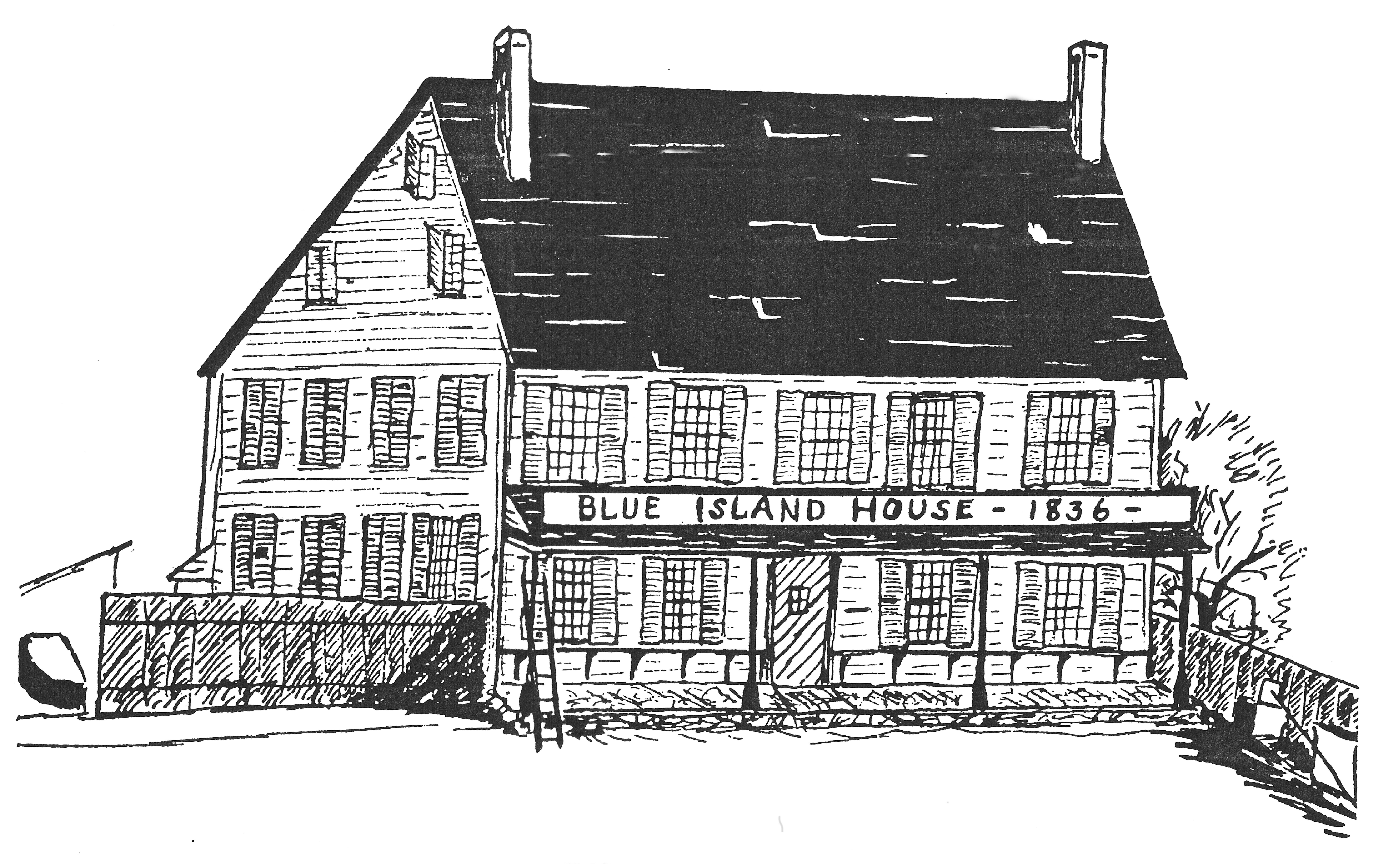
• Blue Island House • The Blue Island House Inn, 1836 - Although no photographs of the building are known to exist, this print is a reproduction of a drawing that was made while the structure was still standing. Until it was destroyed by fire in 1858, the Blue Island House served as the social center not only for Blue Island, but for the surrounding region for many miles as well. Events hosted by the inn frequently lasted until the small hours of the morning, requiring an overnight stay before guests returned the next morning to their homes and places of business in Chicago and the hinterland. It was the first permanent structure built in Blue Island by Norman Rexford. High resolution: 7707 X 4864 image.
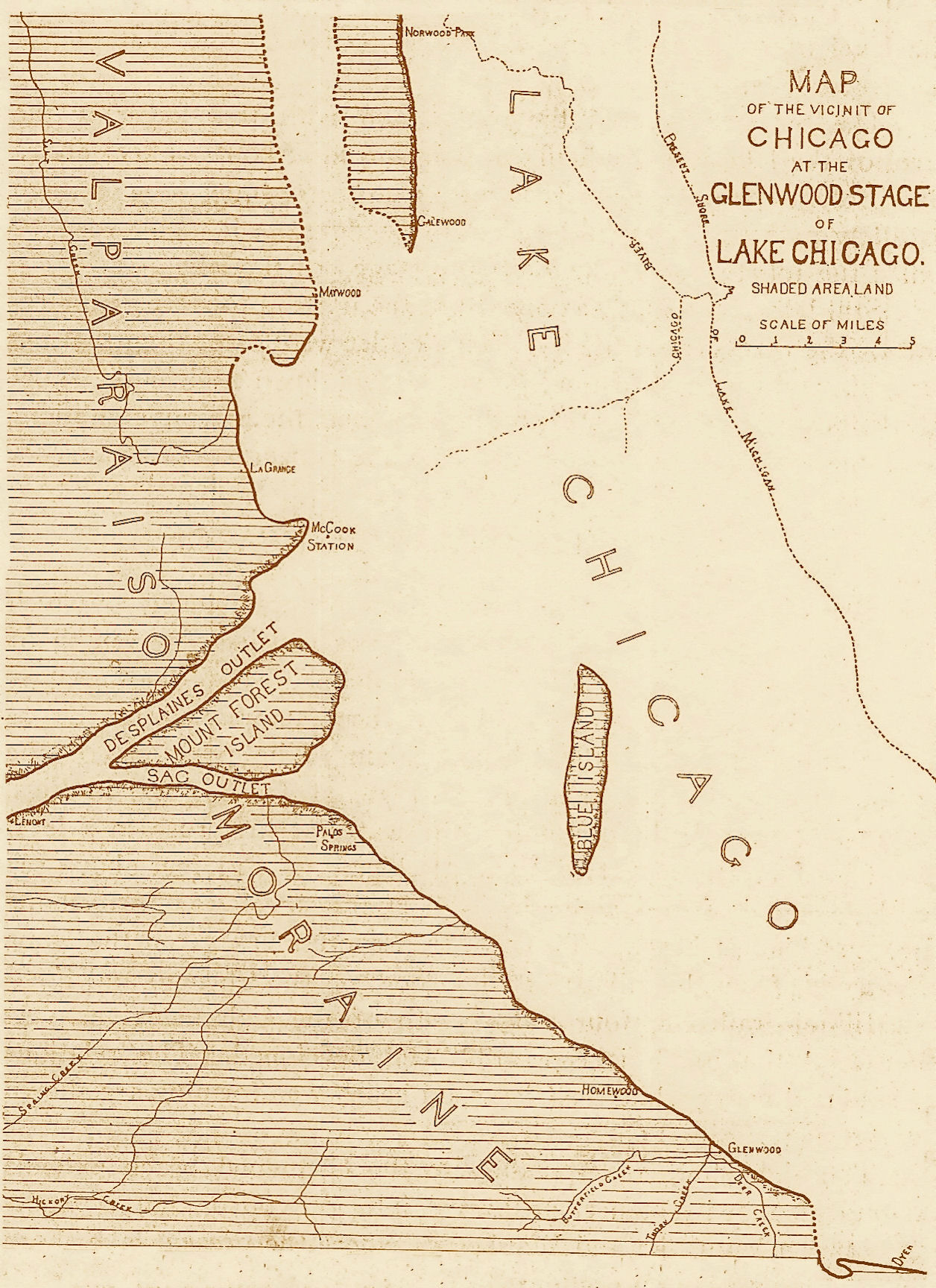
• Lake Chicago •
Lake Chicago at the Glenwood Stage, showing the geological formation of Blue Island (middle lower right) protruding above the waters. The city of Blue Island occupies the lower quarter of the island and the surrounding plain in its vicinity. From The Geographic Society of Chicago, 1899. Large resolution: 1256 X 1728 image.
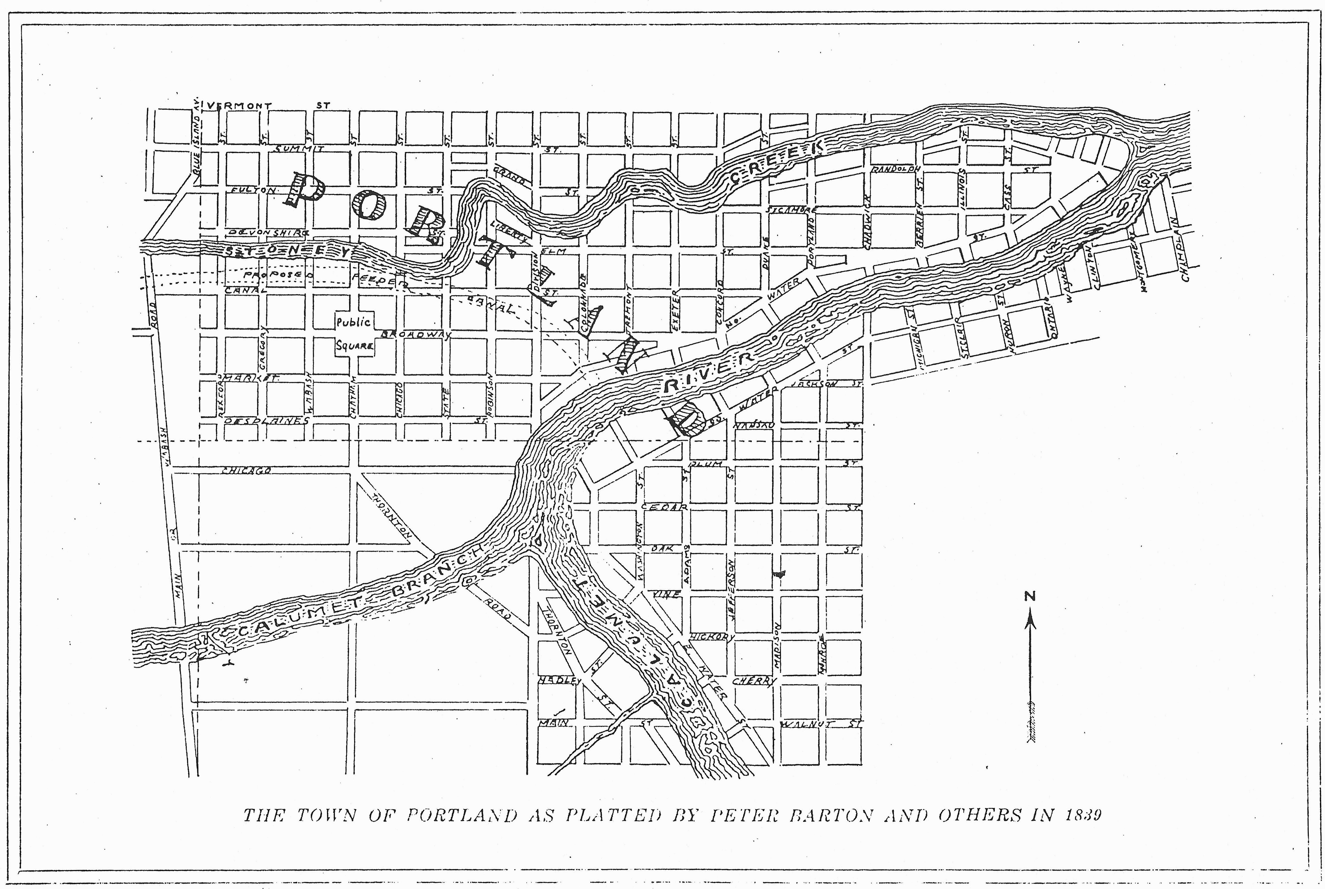
• Plat Of Portland Illinois •
Sketch derived from the plat of Portland, which was registered with the state of Illinois on April 13, 1839. By Peter Barton and his partners (who included Gurdon Hubbard and John H. Kinzie) who hoped to develop Portland as an important river town. "It was thought that the lake commerce by the Calumet and the inland commerce by the feeder, which was planned to be enlarged into a water-way equal to the canal, would make this location of wonderful commercial value. These expectations were never to be realized, however, as the construction of the railroads spoiled these early calculations. The Rock Island swung its line away from the river and built its depot close to the hill, and Portland was forgotten."
Most of the streets shown east of Division Street and all of those shown on the eastern bank of the Calumet River do not exist to this day, and several of those that were constructed elsewhere deviate significantly from the way they are charted here. The section of Portland north of the township boundary line (the phantom line in the middle of the map) and west of Division Street was included within the boundaries of the village when Blue Island incorporated as a village in 1872.
Portland had been laid out on land purchased from the federal government which was situated south of Vermont Street (more or less) and east of Wabash Road (what is now Western Avenue uptown, again, more or less). The Little Calumet River ran through the center of the platted area, and its promoters felt with this advantage that it would become a prosperous river town. They used their influence to have the local post office name changed from Blue Island to Portland (a circumstance that as time went by would be a source of aggravation to the people of Blue Island), and on May 1, 1839, this was accomplished. The post office, however, wasn't located within the platted area of Portland since there were no buildings in which to operate it, but in fact was on contiguous property to the west at the Blue Island House. Portland was never incorporated it existed for many years by and large only as a plat of survey. No buildings of any consequence were erected there for nearly half a century. While some of the street names from Portland remain (although sometimes not entirely on their original courses), any of them that were laid out (and in fact a majority of them never were) waited in most cases for many years until they were needed. About half of the area was eventually annexed within what would become the corporate boundaries of Blue Island as time went by, and significant other sections of it became parts of the village of Calumet Park, the Joe Louis the Champ golf course, and unincorporated Calumet Township.
According to John Volp, whose family had lived in Blue Island since 1862: "'Portland' did not become a river town. Neither did the name 'Portland' ever come into general use. In spite of all the efforts of its promoters to popularize the locality the people preferred to live on top of the hill and call the place 'Blue Island'...". High resolution: 5223 X 3506 image.
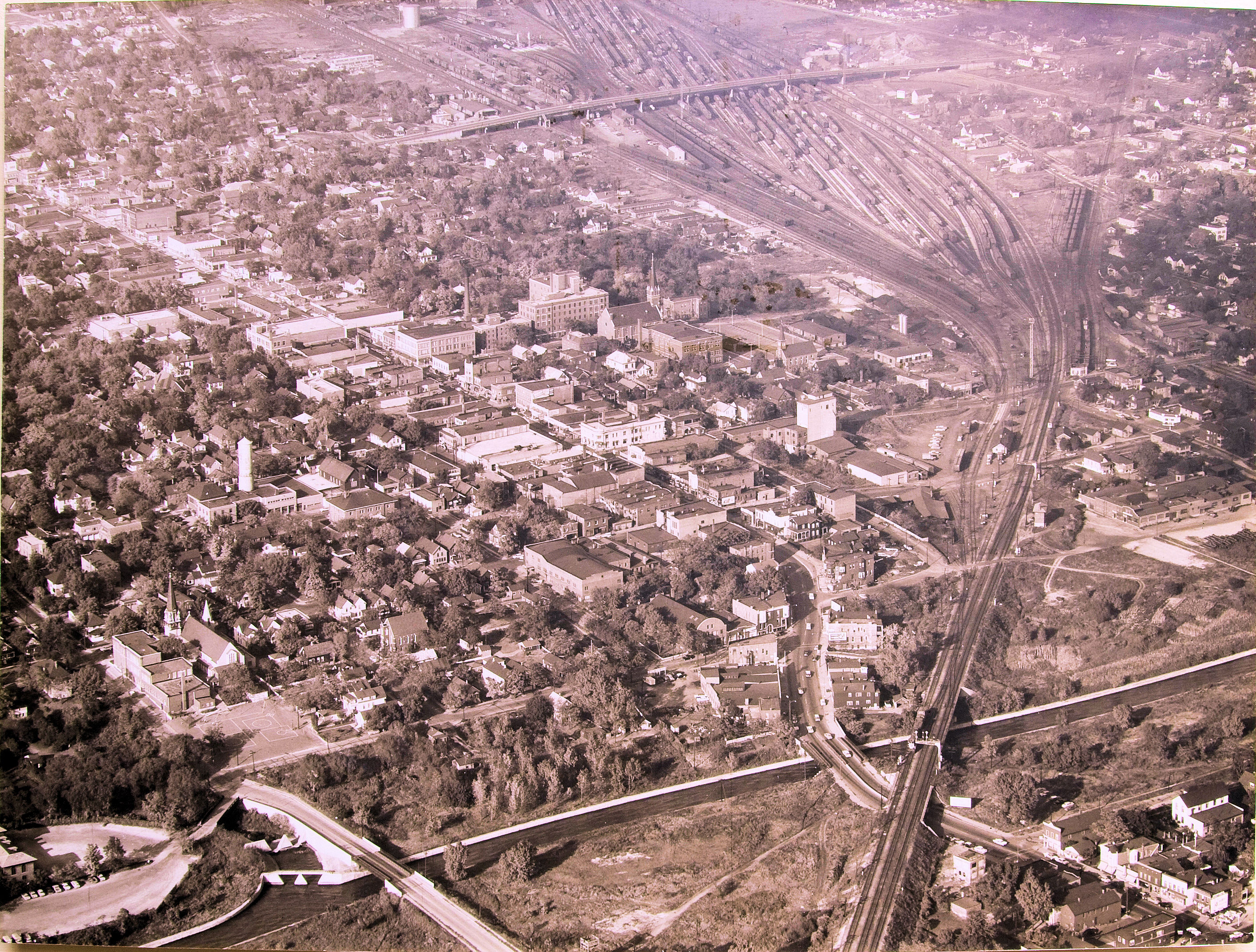
• 1955 Blue Island Aerial Photo • When Western was a two-way street! - from the Blue Island Historical Society; not the greatest image, but considering all the manipulations it has been through, it's acceptable. Resolution: 2829 X 2124